Wrens Nest and Saltwells reserves
12th June 2013
On the 12th June 2013 19 members of the Malvern U3A Geology Group visited the Wren’s Nest National Nature Reserve near Dudley and the Saltwells Local Nature reserve just to the south of Wren’s Nest. The trip was organised by the Mapping sub group on behalf of the main geology group
The visit was hosted by Graham Worton the Keeper of Geology at Dudley Museum and his knowledge, delivery and enthusiasm for all things Black Country and geological were key to the success of the visit and we are all very grateful for his contributions during the day.
WREN’S NEST
The Quarry Trench
This was the first location visited and Graham encouraged us to observe our surroundings and use the basic geological rules of Superposition and Uniformitarianism to work out the history of the trench. The linear nature of the trench tells us it is man-made and that a lot of material has been removed. The landscape on the downhill side is hummocky with young trees of the same age and suggests that this is the spoil heap. Evidence of what was removed is shown by the face of crystalline limestone which was left in place to avoid disrupting the main access track into the rest of the quarries. The limestone was building quality (see Dudley Castle) but was later used for agricultural purposes (burnt and spread to ‘sweeten’ the soil) and to remove impurities from iron production processes. Below this limestone member is the nodular limestone member and this shows large quite thinly bedded planes. Between these two members there are shales inter-bedded with clays and Graham took us through the environmental and sea level conditions associated with each. (The limestones which consist of broken shells indicate a high energy marine environment shallow enough to be affected by wave action, say less than 70m. Clays and mudstones are laid below wave action levels. Limestones interleaved in the clays show that storm events tore up the sea bed and transported it to deeper water. Compare with the Gulf of Mexico today).
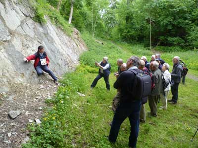
Graham explaining the geology of the environment to the group.
Immediately above the main limestone member is a layer of Bentonite. This rock is rich in a clay mineral montmorillonite and is formed from the weathering of volcanic ash. The minerals in the clay can be used for very accurate radiometric dating as one of the constituents is Zircon which can absorb rare earth metals. In particular the crystal lattice accepts uranium in place of zircon but rejects lead. This means the decay of uranium to lead in the Zircon can be used to date the uranium that was trapped in the Zircon at crystallization using the half-life of uranium. Graham had 200 samples of the Bentonite analysed and this produced a date of 427.77 MYA which is about 4 million years older than previous dating. The International Geology community has accepted this dating.
Abraham Darby’s birthplace
On the way to the next location we paused on a flat area by the road which is the site of a royal hunting lodge which later became a manor house which was the birthplace of Abraham Darby in 1678. Although Abraham is credited as the father of the industrial revolution Graham disputes this as will be explained later.
The Trench Cutting
Our next stop was a trench cut in 1977 to expose the strata below the upper limestone member. This exposed a sequence Bentonite layers (Wren’s Nest has a total of 41 Bentonite layers) some of which have been dated and corroborate the 427.77 MYA date. The oldest date found at the end of the trench was 429.1 MYA which shows that the sequence of rocks exposed in the trench took 1.2 million years to lay down, which is a sobering thought when you stand there looking down the length of it.
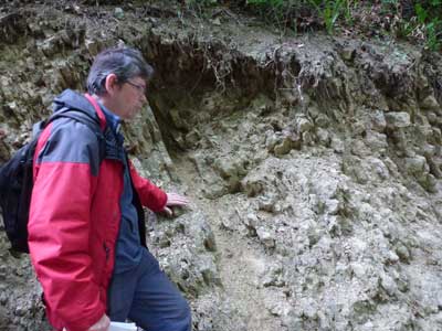
Graham showing us a Bentonite layer.
Murchison’s Viewpoint
We then walked to the famous “Murchison’s viewpoint” from which Sir Roderick Murchison and his wife Charlotte stood and surveyed the landscape in the 1830’s when he was establishing the Silurian sequence. The view towards Dudley Castle shows a series of parallel anticlines, running out into the plains of the South Staffs coalfields. The ridges act as the watershed between waters draining to the Severn and the Trent.
Although Dudley, in the 1830’s, was a small country town it boasted no less than three fossil shops and Murchison bought from them but the owners would not reveal their origin so Murchison approached the miners directly and found an enthusiastic reception to his requests and he became very popular in the area as he communicated his ideas generally. On a later visit he was met by a large crowd and proclaimed “The king of Siluria”
Graham thinks that the Wrens Nest should be the type reference for the Wenlock series rather than Wenlock Edge as there are strata missing from the series there and 65% of the fossils described by Murchison in his work on the Silurian system came from Dudley.
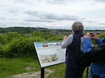
Murchison’s viewpoint.
The Seven Sister’s Mines
These caverns are examples of Pillar and Stall mining where mines are driven into the hillside leaving pillars of limestone behind to support the roof. These were later robbed out once the mine was exhausted. Currently these caverns are blocked by gabions to prevent more collapses occurring. Exposed rock is the lower limestone member of well-bedded limestones with patch reefs visible.
The ripple beds
These are large sheets of the nodular limestone member showing a range of ripple marks of different sizes and patterns from sandy beaches which were lain down in estuaries at a latitude of 20 to 25 degrees south of the equator.
This prompted a discussion on the causes of sea level changes given that there were no polar ice caps at this time. (In fact for 85% of the earth’s history there was no polar ice and the Earth was significantly warmer than now) Causes of sea level changes are the closer proximity of the Moon giving tidal ranges six times higher than now plus ocean displacement caused by lava eruptions at the mid-ocean ridges.
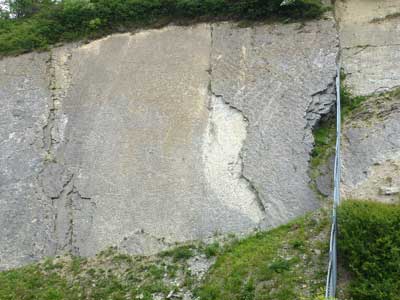
The ripple beds.
THE SALTWELLS NATURE RESERVE
This reserve contains the Doulton’s Claypit and evidence of it’s industrial past including the connection to the West Midlands canal system.
Brewin’s Cutting
We walked up the line of the inclined plain trackway from Doulton’s fireclay pit to the side of the Dudley No. 2 canal. The canal was built to serve the needs of the “walk down” mines quarrying coal, limestone and ironstone. At its peak 141,000 boats a year worked the canals. The Dudley No. 2 mine runs at the 144m contour and has no locks for a total of 50 miles. The canal provided routes to The Wren’s Nest, Birmingham and Wolverhampton.
Brewin’s cutting is a SSSI because of the geological features. Each end of the narrow cutting is bricked as if it was a tunnel which indeed it was originally. The canal was mostly driven through relatively soft sandstones but hit very hard rock at this location. Initially the idea was to bypass the obstacle but this proved impractical and expensive and was abandoned. It was decided to tunnel through the hard rock whatever the length necessary. In the event after only a few feet they broke through into the Downton Castle sandstone again and subsequently dug out the tunnel to a cutting.
The obstacle was if fact a Dolerite dyke dated at 307 MYA which exploited the faulting caused by the folding during the Variscan orogeny.
The exposures in the cutting show a 100 million year gap in the sequences as layers of pebble beds, grit stones and coal lie unconformably on Silurian shales all at the same dip.
The sequence of shales, Downton Castle sandstone (known locally as Gornal grit) and red sandstones indicate a change from marine to deltaic and dry land environments.
Walking back towards the quarry we were shown gas bubbles in the sandstone caused by heating from the intrusion of the Dolerite dyke. Dolerite was quarried and used as roadstone.
Walking back down the inclined plane is also walking back through the sequences which include the difficult to find narrow band of Ludlow Fish Bed. Graham found us a sample of this very loose accumulation of fish scales, bones scorpion and spider legs, although you would need a microscope to see them.
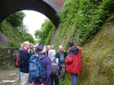
The group at Brewin’s cutting.
Doulton’s Claypit
This area is faulted resulting in the coal measures and fire clay deposits being close to the surface. The fire clay was of good quality and transported to the Doulton ‘bogs and basins’ factory nearby to make sanitary ware. The clay was loaded onto trucks which were attached to a continuous cable system driven by steam engine near the canal and pulled up the incline and tipped into waiting barges. Returning empty trucks provided gravity assistance to help pull the loaded trucks up the slope.
The pit was considerably deeper than it is now and vast quantities of spoil including coal measures were removed and tipped down the hillside to get at the fire clay.
(narrow coal seams were not economic to mine because the main South Staffordshire seam was 36ft thick and provided the fuel to power the industrial revolution.)
At the bottom of the pit is a saline spring coming from the Downton Castle Sandstone. The source of the salt is not known and the salinity has reduced over the years possibly because of pumping from coal mines. There were plans to use the salt water to make Dudley a spa town but this never materialised.
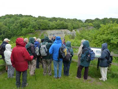
Doulton’s Claypit.
Graham maintains that although Abraham Darby is hailed as the father of the industrial revolution and discoverer of the use of coal and limestone in iron making the real credit belongs to Dud Dudley the natural son of the Earl of Dudley. Queen Elizabeth I banned the production of charcoal to protect the forests as trees were needed for the Elizabethan warships. This ban was a real problem financially for the Earl of Dudley who had 10,000 iron works, glass works and mines in the Dudley area. The newly formed Royal Society was tasked with determining how coal could be used instead of charcoal for iron production. The problem with coal was that it contained impurities and didn’t burn as hot as charcoal and resulted in poor quality iron. The Earl of Dudley also set his son Dud on to the task and he eventually discovered the methods needed using a furnace at Himley Hall. He found that forcing air into the furnace with bellows increased the temperature and adding limestone to the ironstone and coal mixture drew the sulphurous impurities out of the coal as a slag which could be separated from the iron.
Dud Dudley was a troubled soul and had no heirs but his sister had a niece who married John Darby and whose son was Abraham Darby born on the site of Wren’s Nest. Dud wrote a book in 1665, the “Metallus Martis”, describing his iron making methods. It contained a geological map of the Dudley area, 140 yeas before William Smith’s map and 180 years before the BGS maps.
And so concluded and entertaining and informative day out-just before the rain started.